Drive through Highland Park and you see gently rolling lawns on Austin chalk, a formation that stands up fairly well in a cut. Head south toward the Trinity River corridor and you hit Eagle Ford shale, a completely different animal that weathers fast and loses strength the moment it gets wet. That contrast defines slope stability work in Dallas, where the geology changes block by block and a standard approach just does not cut it. We learned this the hard way over years of evaluating cuts for residential foundations and commercial pads across the metroplex. A wall that holds fine in the northern suburbs might need a completely different factor of safety down near the floodplain. When we run a stability model we are not just plugging numbers into software, we are matching the analysis to the actual claystone weathering profile we found on site, often combining field observations with lab shear strength data from our triaxial testing program to nail down the parameters.
Weathered Eagle Ford shale can lose over 40% of its shear strength after just a few wet-dry cycles, and that degradation drives most slope failures we investigate in Dallas County.
Methodology and scope
Site-specific factors
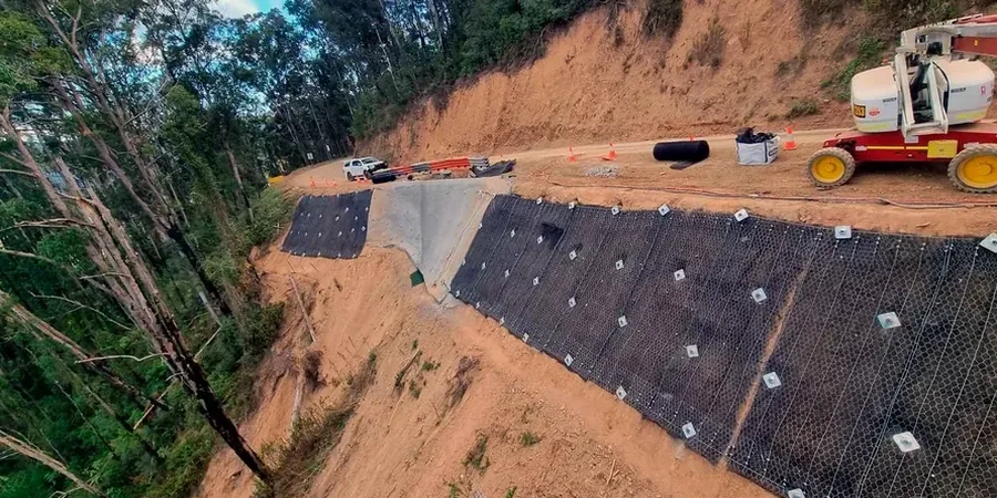
We usually bring a truck-mounted CME-75 drill rig out to the site to push through the weathered crust and get into competent shale, and honestly that machine earns its keep on every slope investigation in this city. The upper five to ten feet can be so fractured and oxidized that you lose circulation immediately, but once you punch through to the unweathered rock the coring tells a completely different story about the formation's real strength. The biggest risk we flag for developers is not the deep-seated rotational failure that shows up in textbooks, it is the progressive shallow sloughing that starts as a tension crack at the crest after a dry spell and then propagates during the next heavy rain event. We have documented this sequence on cut slopes along I-635 and in several residential subdivisions near White Rock Lake. The failure surface rarely goes deeper than eight feet, but it can undermine a footing or a retaining wall just as effectively as a larger slide. That is why our reports always include a drainage management plan alongside the stability calculations, because water control in the weathered zone matters just as much as the factor of safety number on the output sheet.
Relevant standards
IBC Chapter 18 (Soils and Foundations) – slope stability provisions for permanent and temporary excavations, FHWA-NHI-05-037 – Soil Slope and Embankment Design manual, limit equilibrium methodology, ASTM D4767-11 – Consolidated Undrained Triaxial Compression Test for Cohesive Soils, ASCE 7-22 Section 11.4 – Seismic site class and ground motion parameters for pseudo-static analysis, USACE EM 1110-2-1902 – Engineering and Design of Earth Embankments, slope stability acceptance criteria
Related services
Limit Equilibrium and Finite Element Slope Modeling
We build cross-section models in Slide and PLAXIS calibrated to site-specific shear strength data from triaxial and direct shear tests. Every model includes the weathered zone as a distinct material layer with its own strength envelope, because treating the entire profile as uniform shale is the most common mistake we correct in third-party reviews.
Slope Instrumentation and Monitoring
For active cuts near existing structures or critical infrastructure, we install slope inclinometers and vibrating wire piezometers to track deformation and pore pressure in real time. The data feeds back into our stability models so we can confirm design assumptions or trigger mitigation before a failure develops.
Typical parameters
Quick answers
What makes Dallas slope stability analysis different from other Texas cities?
The Eagle Ford shale is the main differentiator. Unlike the stiff clays of Houston or the limestone of San Antonio, Dallas sits on a Cretaceous-aged clay shale that weathers rapidly into a weak, fissured material with very different strength properties than the intact rock. Our analysis has to model this weathered crust as a separate geotechnical unit with lower shear strength and higher permeability, which changes the critical failure surface location significantly.
Do we need a slope stability analysis for a residential lot in Dallas?
If your lot has a planned cut or fill greater than five feet, or if the property is located on a slope steeper than 3H:1V, the City of Dallas building permit review will likely require a geotechnical report with slope stability evaluation. We see this most often in hillside subdivisions in the northern part of the county and along creek corridors where natural slopes have been undercut by development.
How do you handle the expansive clay component in slope design?
The expansive potential of the weathered Eagle Ford shale and overlying residual clays adds a long-term serviceability concern beyond just stability. We quantify swell potential through Atterberg limits and swell-consolidation tests, then incorporate the expected lateral movement into the slope deformation analysis. For slopes adjacent to foundations, we typically recommend a horizontal setback and a moisture barrier system to reduce seasonal wetting and drying at the slope crest.
What is the typical cost range for a slope stability analysis in Dallas?
For a typical residential or light commercial slope evaluation in Dallas, the cost ranges from US$1,300 to US$3,980 depending on the slope height, the number of borings required, and the complexity of the laboratory testing program. A taller slope or one near existing structures will fall on the higher end because of the additional instrumentation and modeling effort.
How long does a slope stability investigation take from start to finish?
Fieldwork including drilling and sampling usually takes two to three days on site. Laboratory triaxial testing runs about three to four weeks due to the consolidation and shear phases. Once we have the lab data, the analysis and report preparation takes another week. In total, plan on four to six weeks from mobilization to final report delivery, a bit longer if we are installing and reading instrumentation over a monitoring period. More info.